


Voting District 609, Richmond city, Virginia
About
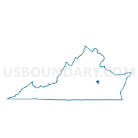
Outline

Summary
| Unique Area Identifier | 683142 |
| Name | Voting District 609 |
| County | Richmond city |
| State | Virginia |
| Area (square miles) | 4.08 |
| Land Area (square miles) | 3.24 |
| Water Area (square miles) | 0.83 |
| % of Land Area | 79.60 |
| % of Water Area | 20.40 |
| Latitude of the Internal Point | 37.50262000 |
| Longtitude of the Internal Point | -77.43007190 |
Maps


Graphs
Select a template below for downloading or customizing gragh for Voting District 609, Richmond city, Virginia


Neighbors
Neighoring Voting District (by Name) Neighboring Voting District on the Map
- Voting District 505, Richmond city, VA
- Voting District 508, Richmond city, VA
- Voting District 510, Richmond city, VA
- Voting District 607, Richmond city, VA
- Voting District 610, Richmond city, VA
- Voting District 706, Richmond city, VA
- Voting District 707, Richmond city, VA
- Voting District 802, Richmond city, VA
- Voting District 806, Richmond city, VA
- Voting District 811, Richmond city, VA
- Drewry's Bluff Voting District, Chesterfield County, VA
- Eanes Voting District, Henrico County, VA
- Sullivans Voting District, Henrico County, VA
Top 10 Neighboring County Subdivision (by Population) Neighboring County Subdivision on the Map
- Richmond city, Richmond city, VA (204,214)
- Bermuda district, Chesterfield County, VA (66,596)
- Varina district, Henrico County, VA (59,349)
Top 10 Neighboring Place (by Population) Neighboring Place on the Map
Top 10 Neighboring Unified School District (by Population) Neighboring Unified School District on the Map
- Chesterfield County Public Schools, VA (316,236)
- Henrico County Public Schools, VA (306,935)
- Richmond City Public Schools, VA (204,214)
Top 10 Neighboring State Legislative District Lower Chamber (by Population) Neighboring State Legislative District Lower Chamber on the Map
- State House District 70, VA (79,380)
- State House District 71, VA (74,194)
- State House District 69, VA (71,299)
Top 10 Neighboring State Legislative District Upper Chamber (by Population) Neighboring State Legislative District Upper Chamber on the Map
Top 10 Neighboring 111th Congressional District (by Population) Neighboring 111th Congressional District on the Map
Top 10 Neighboring Census Tract (by Population) Neighboring Census Tract on the Map
- Census Tract 607, Richmond city, VA (5,010)
- Census Tract 2016.02, Henrico County, VA (4,916)
- Census Tract 305, Richmond city, VA (4,029)
- Census Tract 205, Richmond city, VA (3,851)
- Census Tract 608, Richmond city, VA (3,585)
- Census Tract 610, Richmond city, VA (3,284)
- Census Tract 1003, Chesterfield County, VA (2,457)
- Census Tract 602, Richmond city, VA (2,078)
- Census Tract 211, Richmond city, VA (1,432)
- Census Tract 609, Richmond city, VA (1,311)
Top 10 Neighboring 5-Digit ZIP Code Tabulation Area (by Population) Neighboring 5-Digit ZIP Code Tabulation Area on the Map
- 23223, VA (47,677)
- 23234, VA (42,989)
- 23225, VA (39,169)
- 23231, VA (34,685)
- 23224, VA (33,461)
- 23219, VA (3,781)